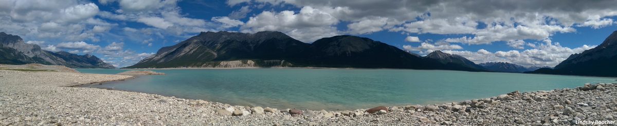

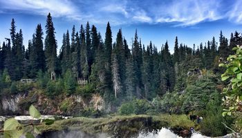
Big Island will be designated an Alberta Provincial Park
Posted on May 10, 2021
Image of Big Island (Courtesy of City of Edmonton)
We applaud the recent announcement indicating a commitment to establish Big Island as a new provincial park.
You are viewing an archived site. Please visit our new site here.
Image of Big Island (Courtesy of City of Edmonton)
We applaud the recent announcement indicating a commitment to establish Big Island as a new provincial park.
On February 8, 2021, Alberta’s Minister of Energy Sonya Savage reinstated the 1976 Coal Policy after the overwhelmingly negative response to the threat posed by coal mining to the Eastern Slopes of the Rockies.


Right now tens of thousands of hectares on the slopes and headwaters of the Rockies are at risk to open-pit coal mining for metallurgical coal.

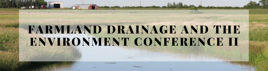
Join us for the second annual Farmland Drainage and the Environment Conference. This year’s virtual conference will address the theme of farmland drainage effects to water and our environment.
Stay tuned with updates on Citizen's Environmental Alliance Facebook Page.
DECEMBER SESSIONS:
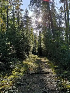
Paved, gravel, natural surface – trails take on a variety of forms. They can traverse great distances into the backcountry, travel through an urban park, or roam through local neighbourhoods. Historically, trails were used for the transport of goods and livestock between local villages and towns. Walking for leisure was a luxury, mostly reserved for those with garden paths or access to local forested trails. Recreational walking grew in popularity in North America at the end of the 19th century and gained traction post-war in the 20th century. The environmental movement of the 1960s and 1970s further inspired people to seek time outdoors in nature for relaxation and fitness.
Nowadays trails are tourist attractions and community refuges for outdoor recreation. Whether planning a long-day hike to a mountain lake, or a short dog-walk close to home, I love to explore new and familiar trails.
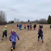
A note about wildlife…
Wildlife can be encountered at any time while on trails. Human-wildlife coexistence is integral to safe and enjoyable recreation that also promotes wildlife conservation.
What is human-wildlife coexistence?
It is a sustainable state that encourages the co-adaption of humans and wildlife that live in shared landscapes. Regarding hiking, it seeks to ensure wildlife conservation while promoting safe human recreation. When planning for your hikes, please keep the local wildlife in mind and leave no trace.
Jill's Top 3 Hikes in Manitoba:
Manitoba is ecologically much more diverse than people realize! Our province ranges from open prairie grasslands to Tundra and even borders an ocean! To outline some incredible variation in ecosystems I’ve chosen three hikes that represent three unique geographic regions and ecosystems. Black bears are common on some of the hikes that I am recommending, so make sure you know how to be wildlife smart and avoid interacting with bears. A bear habituated and used to being around people often becomes a dead bear – so being bear smart is about their safety and yours. Make sure to always check local advisories and warnings regarding weather and wildlife before heading out on your hike.
Location: Whiteshell Provincial Park
Distance: 12.6km out and back
Elevation: 210m
Type: Moderate day hike
Difficulty: Moderate (rated as difficult due to the uneven terrain).
Website: Manitoba Parks
Ecozone: Lake of the Woods, Boreal Shield
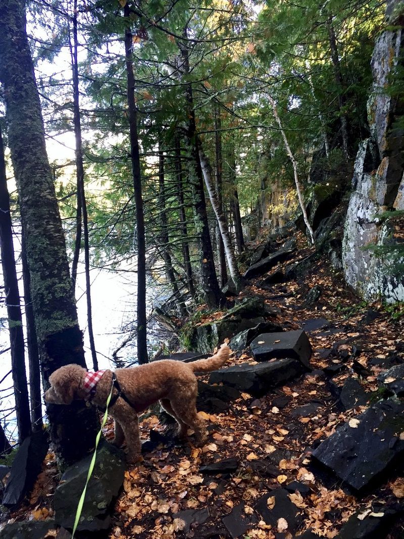
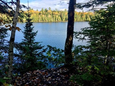
The trail begins at the Hunt Lake Parking lot and follows the Eastern edge of West Hawk Lake for the majority of the trail. West Hawk Lake was formed by a meteorite impact, making it Manitoba’s deepest lake. As a result, the terrain around the lake is rugged a features granite cliffs along the trail. There are several sections of steep rocks, a few boggy areas (especially in spring) and the terrain is generally uneven. Make sure to wear hiking boots and bring bug spray depending on the season. The majority of the hike is in the shade and next to the lake, which is great if some of your hiking companions have four legs. Make sure dogs remain on leash while hiking, since this trail is in bear country.
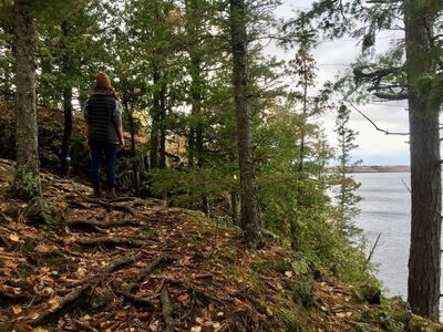
You’ll encounter beautiful outcrops of granite and Precambrian Canadian shield all along the hike and see trees interwoven through the rocks over time. Along this trail you’ll find cedars and the westernmost Eastern White Pine in Canada. These giant Eastern White Pines tower over the forest canopy and can be easily seen at a distance. This ecosystem is known as the Manitoba Lowlands Natural Region, and the park is classified as a Natural Park – which means that the purpose of the park is to preserve this ecosystem.
At the end of the trail you’ll find a cook shelter where you can make a fire and enjoy the views. All along the trail you’ll find stunning views and places suitable to go for a swim on a hot day.
Take your time to enjoy this hike and bring along a picnic to enjoy at the halfway point.
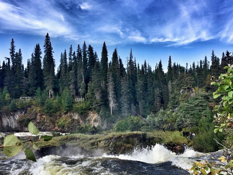
Location: Pisew Falls Provincial Park (74 km / 46 mi. south of Thompson on PTH 6)
Distance: 27.4km loop
Elevation: 678m
Type: Multi-day hike, backcountry camping
Difficulty: Difficult
Website: Manitoba Parks
Ecozone: Hayes River Upland, Boreal Shield
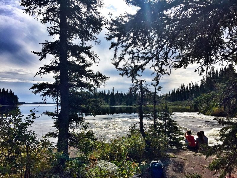
Come prepared for this hike as wet weather can change estimated hiking times dramatically, and signage can be difficult to follow at times. Hikers can take the slightly shorter Philips Lake Route or the Grass River route to get to Kwasitchewan Falls, Manitoba’s highest waterfall. You’ll hike amidst pine, spruce, poplar and tamarak trees.
Black bears, wolves and cougar are frequently reported in the area. Make sure to follow all hiking recommendations from Manitoba Parks and check out the First Steps section of the trail guide to know how to prepare.
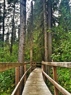
Not quite ready for an overnight hike? No problem! This hike begins at Pisew Falls, which is easily accessible after a short but stunning walk along a boardwalk to the falls. The name Pisew is from the Cree word for lynx, as the hissing sound of the falls resembled that of the lynx. Continue along the Grass Trail lake side of the hike to follow a well-travelled route that Indigenous peoples showed to fur traders. Consider doing an out and back along this section of the trail, but be mindful to bring proper supplies and expect your route to take longer than expected.
Note: The backcountry campsites are also accessible by canoe.
Location: Spruce Woods Provincial Park. From Winnipeg: travel west on Highway 1, turn south on P.T.H. 5 for 29 kilometres. From P.T.H. 2 west turn north on P.T.H. 5 for 13 kilometres. Kiche Manitou is approximately 180 kilometres from Winnipeg.
Distance: 10km
Type: Loop, day hike
Difficulty: Moderate
Website: Manitoba Parks Trail Brochure
Ecozone: Lake Manitoba Plain, Aspen Parkland
Note: There is an equestrian campground for horseback riders.
Photo credit: Lawrence Medel
The trail passes through a varied landscape of sand dunes, grassland and forested area. You’ll find several species of snakes in the park along with Manitoba’s only lizard: the Prairie Skink! The trail ends at the Devil’s Punch Bowl, which gets its blue-green colour and is fed from an underground stream. While the site is known as Manitoba’s desert, it actually gets nearly twice the amount of annual precipitation of what a desert would get. This results in an interesting combination of biodiversity and the varied landscape that makes this hike visually stunning. Go in autumn, when temperatures are cooler (shade can be limited along the trail) and the fall foliage is on full display.
The full loop is 10km, but there are several other options for trails in the park. Poison ivy is prevalent in the park – stay on the trail.
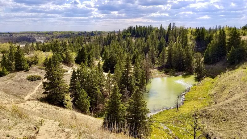
Photo credit: Lawrence Medel
Join us this Fall, as our team will be taking a special hike in support of THE NATIONAL HIKE FOR THE ENVIRONMENT.
This nation-wide event will help re-connect people across the country with the natural world that sustains us, while raising support for the challenging work of Sierra Club Canada Foundation and our efforts to fight for urgent environmental protections.
Want to be a Hiking Hero?
1) Sign up on our CanadaHelps page as an individual or part of the Prairie Chapter Team.
2) Ask 10 friends to donate to your cause
3) Go for a hike! This can be on a mountain, on a favoured walking trail, indoors with your walking group, or even around your neighbourhood.
Paved, gravel, natural surface – trails take on a variety of forms. They can traverse great distances into the backcountry, travel through an urban park, or roam through local neighbourhoods. Historically, trails were used for the transport of goods and livestock between local villages and towns. Walking for leisure was a luxury, mostly reserved for those with garden paths or access to local forested trails. Recreational walking grew in popularity in North America at the end of the 19th century and gained traction post-war in the 20th century. The environmental movement of the 1960s and 1970s further inspired people to seek time outdoors in nature for relaxation and fitness.
Nowadays trails are tourist attractions and community refuges for outdoor recreation. I love to explore new and familiar trails.
A note about wildlife…
Wildlife can be encountered at any time while on trails. Human-wildlife coexistence is integral to safe and enjoyable recreation that also promotes wildlife conservation.
What is human-wildlife coexistence?
It is a sustainable state that encourages the co-adaption of humans and wildlife that live in shared landscapes. Regarding hiking, it seeks to ensure wildlife conservation while promoting safe human recreation. When planning for your hikes, please keep the local wildlife in mind and leave no trace.
Hiking In Saskatchewan
Saskatchewan boasts many beautiful landscapes that are unique to our province! Long associated with endless flat wheat fields, the province has so much more, including landscapes that people from elsewhere wouldn’t associate with Saskatchewan. It’s far from flat and featureless, and is home to species of plants and animals you can’t find elsewhere. Here are three hikes that may shift your perspective on what you think Saskatchewan has to offer.
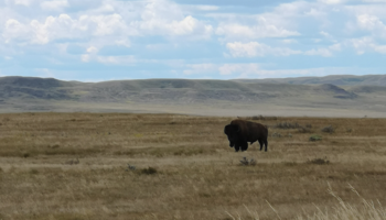
Location: West Block of Grasslands National Park, Saskatchewan
Distance: 17km loop
Type: Day hike (5 or 6 hours)
Difficulty: Difficult
Website: Canada Parks Website

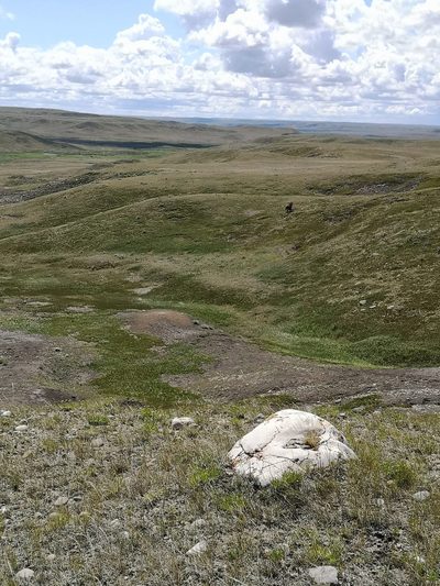
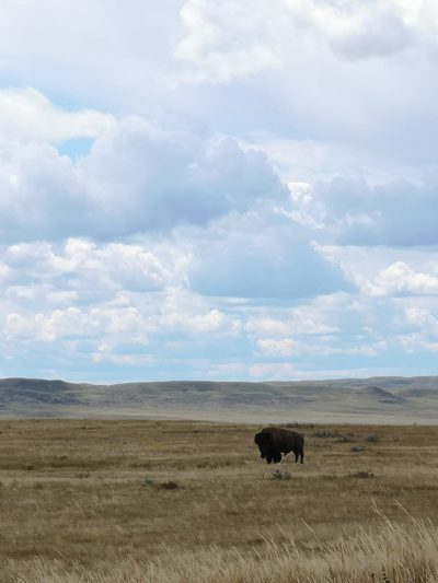
First, let’s start with a trail that highlights what “real” prairies are – unploughed grasslands. This hike is found in the West Block of Grasslands National Park, a park split into two sections about two hours’ drive apart, both along the American border. To immerse yourself in the rolling grasslands – an endangered ecosystem, in part because it makes such good farmland – and have a chance at spotting bison and burrowing owls, check out the West Block. Grasslands National Park has some trails loosely marked with flat plastic posts, but if you get lost (the posts sometimes get knocked down by bison) or deliberately step off trail to chase the horizon, the visitor guide has the GPS coordinates of the trailhead so you can find your way back.
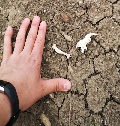
I first hiked this trail in the summer of 2020. It’s easy to practice physical distancing when the land is so vast! Stepping out of my vehicle, I always read the interpretive panels and the information signs at the trailheads. The first thing that caught my eye at this one were the warnings – you should be coming prepared with enough water, and be on the lookout for rattlesnakes, bison, prairie dog holes, and “feeling small in a big landscape.”
This is a landscape that is experienced either at the micro end or the macro end of the scale – I’m either crouched down looking at some small lichen clinging to a rock or the jaw of a prairie dog kicked up from a tunnel in one of their colonies, or taking in the immense view, where you can see for tens of kilometres around. The hills and coulees unfurl before you. For those who are used to hiking in a treed landscape, you may be surprised at the diversity of views before you.
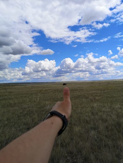
Bring binoculars, not only to watch for birds, but to also check if those distant dots are cattle or bison. As a professional bison aficionada, I was always thrilled when we encountered bison – giving them their space of course. How close is too close? Use your thumb: hold up your hand in a thumb’s up position at arm’s length. If you can completely cover the animal with your thumb, you’re usually a safe distance to be on foot.
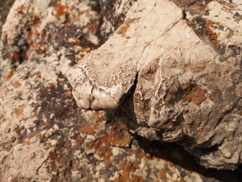
If you know what to look for, there are also little things that thrill. For me, that’s when I encountered numerous buffalo rubbing stones. They are erratics: large stones dropped by retreating glaciers millennia ago. They’re also perfect places for bison to scratch that itchy spot. One boulder I found, surrounded by hoof prints, had corners rubbed smooth and shiny. That wasn’t from the bison herd that had been reintroduced in 2005. That takes generations of bison rubbing that one spot. That was a historical rubbing stone, used by the herds of hundreds of thousands of individuals well into the 19th century, rediscovered by this small herd in the 21st.
This landscape has a depth of history, and a depth of view that is almost unparalleled.
Location: Prince Albert National Park, Saskatchewan
Distance: 2km
Type: Short hike
Difficulty: Easy
Website: Canada Parks Website
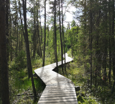
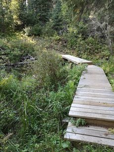
This trail is perfect for a short ramble. If you’re really cruising along, you can finish the trail in 30 or 40 minutes, but that means that you would miss so much! This is definitely the kind of trail where you want to stop and smell the metaphorical roses. The trail winds across rocky treed ridges and past knobs and kettles, and then across boardwalks that take you out over bogs and fens. There are thick beds of vibrant green moss, extensive patches of Labrador tea, and a whole bunch of small stunted tamarack (larch) trees. The first time I hiked this trail it was in the middle of winter and I was on snowshoes. The world had felt very black and white, the air as crisp as the snow. I emerged out among the tamaracks, and they were covered in such vibrant lichen that it was as if I’d stepped from the greyscale world of mid-winter into colour film.
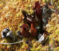
In the fall, there are dozens of species of fungi to discover. In the spring, wildflowers can be found just off trail. However, my favourite part about this hike is that you can spot not one but three types of carnivorous plants, sometimes within one square metre of each other.
The easiest to find and the most alien-looking is the pitcher plant. They’re purple and green and veined, and their flowers look like strange sci-fi periscopes.
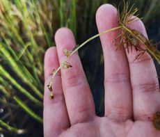
Plunge your hand into the water if you dare and lift up a string of bladderwort: an underwater plant with tiny pockets or bladders to catch macroinvertebrates. (Be sure to put it back after admiring!)
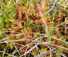
On some of the small mossy hummocks among the tamaracks you can find the sundew, which look like flat sticky cousins of the venus fly trap, only the size of my pinkie fingernail.
Before hiking this trail, I always thought you could only find carnivorous plants in the tropics, but here they are in the boreal forest of northern Saskatchewan! Remember how I said that if you’re in a rush you can finish this trail in thirty minutes? I’ve spent nearly 3 hours at a time on this trail, stopping to admire, examine, and photograph the natural world around me.
Location: Prince Albert National Park, Saskatchewan
Distance: 40km return
Type: One or two night overnight (recommended)
Difficulty: Difficult
Website: Canada Parks Website
This is likely the most famous of the trails of Prince Albert National Park. This one is not only about the journey but also about the destination. It’s 20km to get to the two cabins on Ajawaan Lake, then 20km back. At Ajawaan are two cabins and three grave sites. Archibald Belaney, AKA Grey Owl, was a conservationist originally from Hastings, England, who took on a false “Indian” identity in the 1920s and 1930s. Anahareo, a Mohawk woman and a conservationist and author in her own right, married him, and they both lived alongside their pet beavers first in Riding Mountain National Park, then Prince Albert National Park. They are buried near the cabins with their daughter Shirley Dawn. When people make the hike to “Grey Owl’s Cabin”, they are making a pilgrimage to the grave sites of prominent if imperfect and therefore very human conservationists.
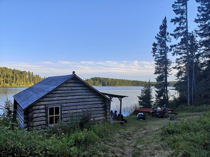
The trek itself is a challenge but achievable. You can do it by boat or by canoe along Kingsmere Lake. If you are going by water, plan to be delayed, though, as it’s notoriously choppy when windy, making further travel impossible. I’ve done it on foot, and the path may be full of roots but the views of the lakes are gorgeous. The path follows first the Kingsmere River, then parallel to Kingsmere Lake, for over a dozen kilometres, before you hike a short portage to get to the calm waters of Ajawaan. Being in such close proximity to bodies of water for the whole length of the hike, too, means that if you have a good water filter, you don’t have to carry in enough water to last you the whole time – you can pump or filter straight from the lake.
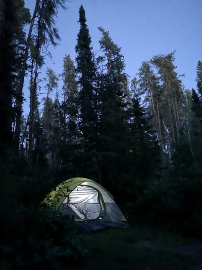
While some intrepid souls get to the trailhead really early, hike all day, and get back to their vehicles quite late (something only possible because of the long summer days), I prefer to do it as an overnight backcountry trip. If you’re just getting into backcountry camping, this is a perfect way to test out your gear and your mettle. The campsites are as “front country” as you can get in the back country, with fire pits, picnic tables, pit toilets, and piles of fire wood. The first night I ever camped out on the Grey Owl Trail, the aurora came out right after sunset. “Magical” doesn’t do it justice.
Join us this Fall, as our team will be taking a special hike in support of THE NATIONAL HIKE FOR THE ENVIRONMENT.
This nation-wide event will help re-connect people across the country with the natural world that sustains us, while raising support for the challenging work of Sierra Club Canada Foundation and our efforts to fight for urgent environmental protections.
Want to be a Hiking Hero?
1) Sign up on our CanadaHelps page as an individual or part of the Prairie Chapter Team.
2) Ask 10 friends to donate to your cause
3) Go for a hike! This can be on a mountain, on a favoured walking trail, indoors with your walking group, or even around your neighbourhood.
Paved, gravel, natural surface – trails take on a variety of forms. They can traverse great distances into the backcountry, travel through an urban park, or roam through local neighbourhoods. Historically, trails were used for the transport of goods and livestock between local villages and towns. Walking for leisure was a luxury, mostly reserved for those with garden paths or access to local forested trails. Recreational walking grew in popularity in North America at the end of the 19th century and gained traction post-war in the 20th century.

Who could have predicted that in 2020 we would have to make to collective decision to stay inside our living room for extended period of time? These have been hard times for many.
We wanted to celebrate the hard decision our community has made to physically distance during Covid-19 by providing a new 'living room'. This living room is green, playful, beautiful and reflects our local flora. Now more than ever we need the benefits of nature for our physical and mental health.

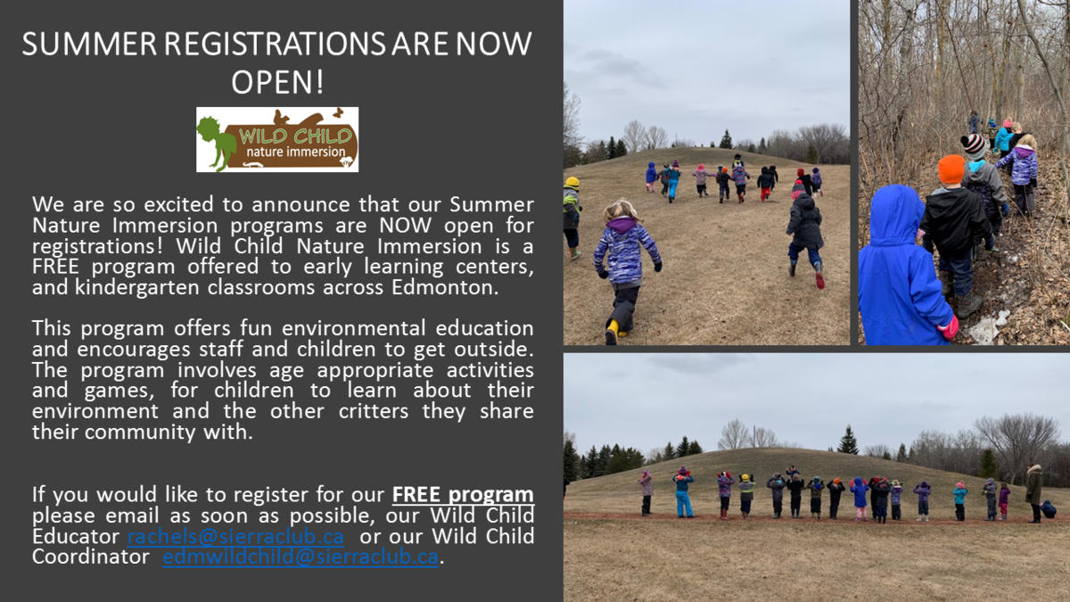
EDMONTON (April 8, 20200 — Edmonton Wild Child of Sierra Club Canada Foundation is supporting Edmontonians by providing an online platform to connect and support with distance learning designed to allow students to build a relationship with nature with their familiesfrom home (e.g. weekly videos, online resources such as a blog and printable materials), and at the same time reduce isolation by providing families an opportunity to feel part of a community.

For Immediate Release
Edmonton, AB - (March 9, 2020) Sierra Club Canada Foundation is deeply concerned about the degradation of Alberta’s parks and the impacts these changes will have for conservation, wildlife habitat, accessible recreation, and the status of protected areas in Alberta. Sierra Club Canada Foundation recognizes that habitat alteration and elimination poses the single greatest threat to the continued well-being of healthy and diverse wildlife populations.
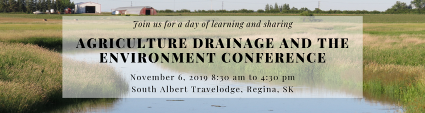
For registration, click here!
Presentations from a range of speakers including Dr. John Pomeroy - Global Institute for Water Security, the Saskatchewan Farm Stewardship Association, and the School of Environment and Sustainability - U of S will cover many topics such as:

Written by Jaclyn Layton
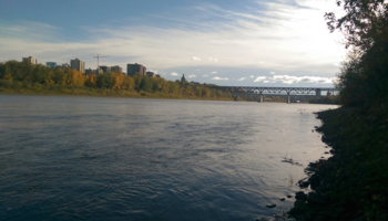
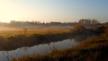
With over 72 square kilometres of lush river valley, Edmonton presents a unique intersection of urban and green space. More expansive than Stanley Park of Vancouver (4 square kilometres), or even Central Park in New York City (3.4 square kilometres), Edmonton’s greenery is an aspect of the city that is celebrated, and therefore should be preserved and protected. The natural wonder of the North Saskatchewan River Valley has been at risk over the past 18 months over a proposed solar farm that would degrade the Valley’s natural state.
Edmonton City Bylaw 7188
The North Saskatchewan River Valley Area Redevelopment Plan is a comprehensive plan which envisions the major portion of the River Valley and Ravine System for use as an environmental protection area and for major urban and natural parks. […] As Edmonton grows and changes and as land becomes more valuable the River Valley may become the threatened by commercial and industrial uses, as well as by civic uses such as public utilities. The municipal level of government has probably exerted the greatest development pressure on the River Valley with public utility proposals and transportation plans. These uses tend to be incompatible with the aims of nature preservation and parkland development.
Those excerpts from our North Saskatchewan River Valley Area Re-development Plan, Bylaw 7188, are found in its purpose, which is explicit in its regard for the importance of protecting our river valley and ravine system. The details surrounding exceptions are strict, and the bar set high. Give it a read.
Sierra Club Canada Foundation is determined in its effort to conserve our River Valley, Edmonton’s most unique and valuable asset.
Written by Warrick Baijius, Endangered Grassland Alliance
Saskatoon, SK, is a vibrant and growing prairie city within an agricultural landscape. But in and around Saskatoon there are some enchanting and ever-changing natural sites, gems that provide a glimpse into pre-settlement landscapes. These areas include complex and diverse combinations of native plant and animal communities, housed and fed in a mosaic of diverse habitats influenced by erosion, grazing, and fire. Some of these areas have fescue and mixed grassland prairie —globally the most threatened ecosystem, and regionally an increasingly rare occurrence (at 5% of original extent for fescue, and 9% to 15% for mixed).

On April 16, 2019 Alberta joins the rest of the Prairie provinces with a majority conservative government.
In light of a polarizing campaign putting the environment at odds with economic development, the questions begs, how do move forward together?
Sierra Club Canada Foundation (SCCF) has been instrumental in advocating for green areas in urban settings for years in Alberta’s capital region.